Tree & Terrain Mapping GmbH
Hochaufgelöste Gelände- und Walddaten
Wir machen aus Fernerkundungsdaten wie flugzeuggestützten Laserscans oder Luftbildern präzise, direkt nutzbare Geodaten — hektarweise zum Download. Unser Fokus: Daten, die in der forstlichen Praxis und Planung unmittelbar weiterhelfen. Fachlich fundiert, reproduzierbar und flächendeckend.
Das Team

Max Freudenberg
Was uns auszeichnet
Akademische Wurzeln
Entstanden aus dem universitären Umfeld in Göttingen: Max Freudenberg und Tanja Kempen promovieren an der Universität Göttingen. Wissenschaftliche Sorgfalt gehört bei uns einfach dazu.
KI trifft Fernerkundung
Seit 2018 arbeiten wir an der Schnittstelle von Künstlicher Intelligenz und Fernerkundung — begutachtete Publikationen inklusive.
Forstexpertise
Wir kennen die Anforderungen der forstlichen Praxis und sprechen die Sprache der Anwender.
Standort Göttingen
Zentral in Deutschland und mitten in einem der großen forstwissenschaftlichen Standorte.
Unsere Produkte
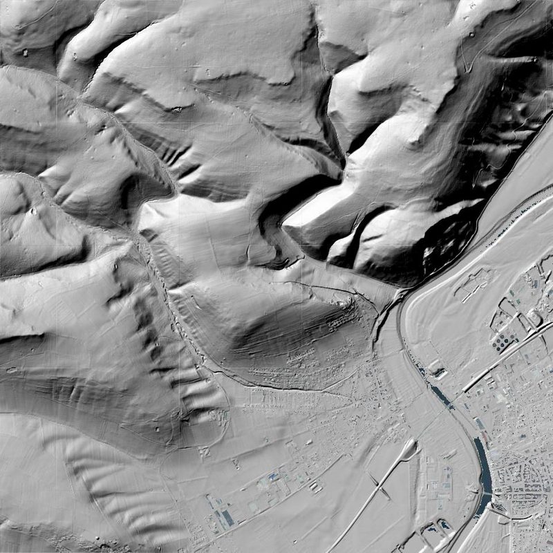
Geländemodelle (DGM)
Digitale Geländemodelle mit hoher Detailtreue — Grundlage für Planung, Hydrologie und forstliche Analysen.
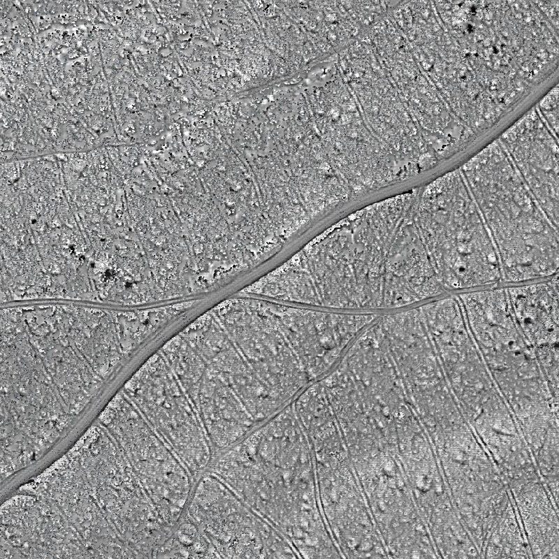
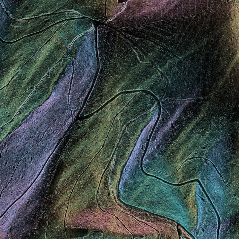
Gelände-Reliefkarten
Reliefdarstellungen feiner Bodenstrukturen — auch in dicht bewaldeten Gebieten.
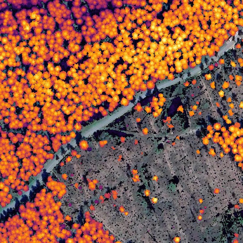
Baumhöhen
Flächendeckende Baumhöhenmodelle für Bestandsbeurteilung, Biomasseschätzung und Veränderungsdetektion.
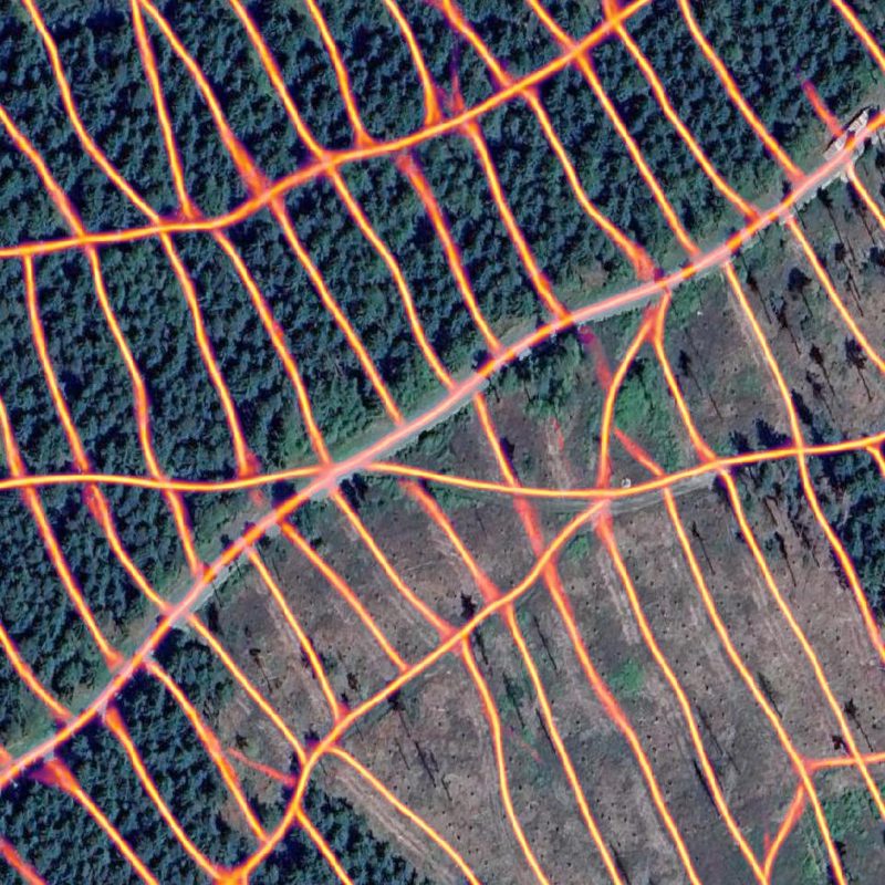
Rückegassen-Karten
Detaillierte Kartierung der Grob- und Feinerschließung — auch zur Reaktivierung bestehender Rückegassen auf Kalamitätsflächen.
Hangneigungskarten
Ideal zur Abschätzung der Befahrbarkeit.
Preise & Verfügbarkeit
Preise und verfügbare Regionen gibt es auf Anfrage — schreiben Sie uns einfach an info@treeandterrain.de. Wir melden uns zeitnah.